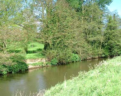
The River Wey Flows downstream eastwards from Farnham, Tilford and Elstead
past Peper Harow on its way to Eashing and on to Godalming, then onto Guildford
past Sutton Place and on to reach the River Thames at Sunbury?
From Godalming onwards it is navigateble, the first Lock is at Godalming
where narrow boats are for hire.
Near Sutton Place there is a beautiful bridge over the river.
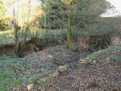
There are the remains of a Deer bridge at the western edge of Peper Harow
that was to enable wild deer on the park to roam over Oxenford meadow.
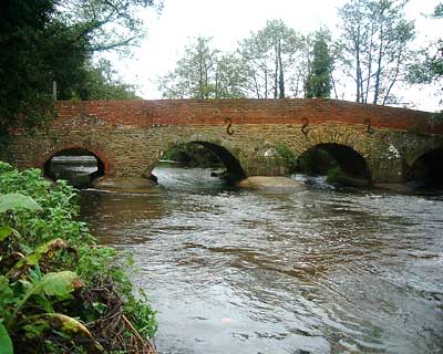
There is a three arch brick bridge over the river to Oxenford
which was once the main approach to the Mansion.
Peper Harow Fly Fishing Club has fishing rights on the south bank of the river 'Oxenford Meadow' on the field belonging to Farmer Mr Baker
Fishing Rights on the North bank belong to the respective landowners, who have river frontage.
These can be bought over the counter at any Main Post Office,
or you can buy online with The Environment Agency at
www.environment-agency.gov.uk/fish
Or by phone on 0870 1662662 using your credit/debit card, +admin charge of
90p.
All Rod Licences expire on 31 March each year, whenever bought.
Children under 12 years do not require a licence.
| Full Licence for Non Migratory Trout & Coarse Fish | �22.00 |
| Junior Concessionary less than 17years | �5.00 |
| Other Concessionary 65years or over | �11.00 |
| 8 Day Adult Licence | �8.00 |
| 1 Day Adult Licence | �2.75 |
This Goverment agency is responsible for all matters do with the river water, controlling flood etc. and the water level can be controlled by the locks at Godalming and Guildford.
They sample the water from time to time and investigate any pollution, they sample outfalls from sewage treatment works regulary.
In the summer we see canoes on the river quite often, and they occasional digny or inflatable.
goto to TopThe water is not suitable for swimming in as there is a large sewage works at Elsted and although filtered may cause infections if you have a open wound or mouth!, I have waded about in it picking out rubbish and fallen trees but I take care not to cut myself.
The Water flow is only safe when low after a dry spell, the average depth in the middle is about 4 feet, after rain its gets to 5 feet deep and the current can be very strong and could easily sweep an adult of your feet, resulting in a danger of drowning as some of the banks are too high too scramble out.
There is a story I have hear of about, a few years ago a Cow got stuck in the river and it took the Fire Brigade and a crane to rescue it.
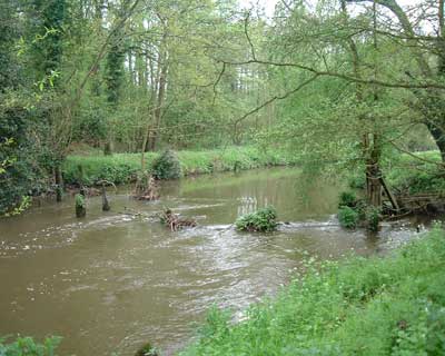
The new Riffle is a new hazard but there are others:
Canoeists must look ahead and 'read' the water to avoid running into
obstructions or running aground.
There are some under water deflectors, mostly midstream, these are groups of posts just below the water line, these are refuges for the fish, unfortunatley they are just right for grounding your canoe/digny/inflateable.
This bridge is an old stone bridge with brick walls to contain the
road traffic.
There is a full width weir on the upstream side, visable though the
arches.
This bridge is a ruin, and only a few posts sticking out of the water give any indication of its position, at OS ref: SU 9297E 4389N
Originally it would have been soley for the herd of deer in the park to roam over oxenford meadow for fresh pasture.
It is at the North Western corner of Oxenford meadow.
This has been created by the Environment Agency recently (November 2003), with shallows upstream to encourage fish to lay their eggs.
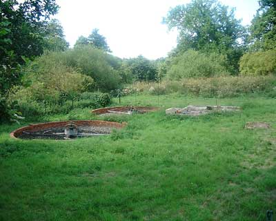
This Landing stage with mooring rings to tie upto is near the Riffle and Gun emplacement, and pausing boats can top up with fresh cold drinking water from the Nymph pool spring, just to right of the landing stage.
The Boat House is a ruin with only the brick foundation walls still showing, and the docks are all silted up.
This sewage treatment plant is owned and managed by:
Peper Harow Residents Association Ltd.
It processes foul water from:
1-12 Park Av,
Old Cedars
Dairy Cottage
The Old Laundry
The Carriage House
The Courtyard House
1-9 Peper Harow House
Our Consent Number is: CASM.0125 Version: 1
The system is inspected monthy emptied annually and all records kept.
There is a DANGER sign on the locked gate, warning of deep tanks and moving mechanism.
In case of an emergency contact your representative director.
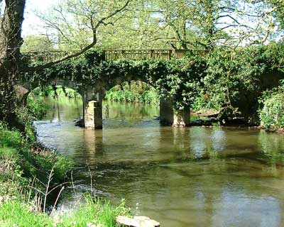
There is a three arch Bridge over the river Wey to Oxenford, it was once the main entrance to Peper Harow House.
The south side of this bridge forms a boundary between Oxenford meadow land and farmland to the north, and has a closed & locked gate, which is only opened once a year to allow pedestrians to go to the May-Day point-to point races.
From West to East.
Ditch by Weir - from 'The Stew' pond.
Nymph Pool/Land drainage.
Surface water off road from South yard of mansion.
Surface water from East side of mansion.
Water from duck pond via old brick culvert.
Land Drain Ditch from Oxenford Meadow.
Spring water from Bathhouse folly.
Sewage works filtered water.
Land drain ditch by Boathouse.
Land drian ditch by Oxenford bridge south.
Ditch from lake in Eashing Moor Copse.
Spring water from Bonville Spring (The Lions Mouth).
? A3 Road drain from front drive gates.